Property Description
The Toll house has been described as “originally situated at the crossroads on the North side of the Little Dart River” but this probably refers to the crossroads at Thornham Cross (aka Worlington Gate) where the road from Wilsons Farm to East Worlington crosses the South Molton to Exeter toll road (see below) which is roughly 3/4 mile north of the bridge over the Little Dart at Drayford.
In the 1851 census it was recorded as the Toll House with William and Sarah Flew as tollkeepers.
From 1871-1901 there are occupants who are not tollkeepers. and no records of the property after 1901.
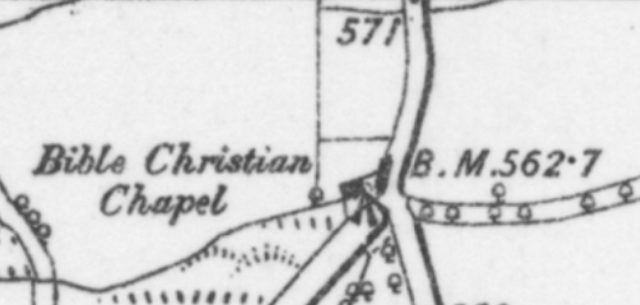
Local research suggests that when building Thornham Chapel the east end was on the site of the old toll house. This fits with the OS 25 inch map shown above which highlights the older Bible Christian chapel and the tollhouse as separate (pink) structures.
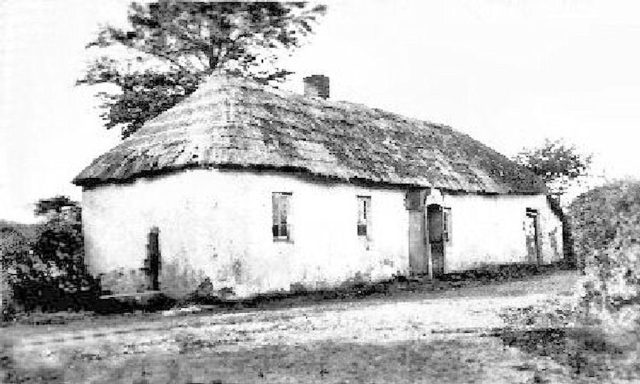
The tollhouse on all the older maps is right by the road and the picture shows a porch jutting into the road which is a common theme for tollhouses. Somewhere for the tollkeeper to sit and stay dry and have a clear view of the road. Early tollhouses were often adapted buildings in the right location. Only later were custom (better quality) toll houses built (Kenerleigh is a good example).
Toll Roads
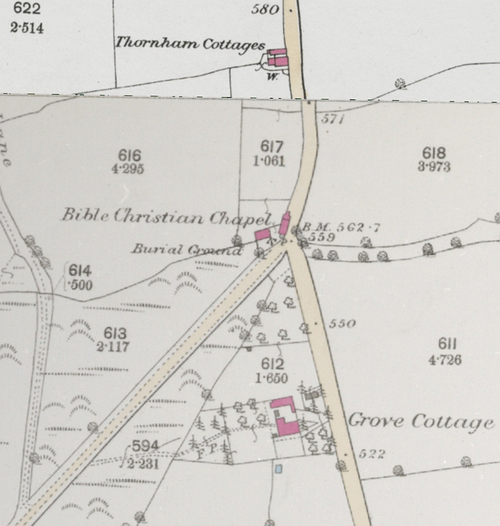
OS 25 inch map 1888
Turnpike roads and Toll Houses in England in the the 17th and 19th centuries were primarily used for funding the repair and improvement of the country’s main road network. They allowed for faster, more reliable transport of goods and people by using revenue from tolls to improve road quality, build new routes, and create infrastructure like bridges.
A South Molton Turnpike Road was created in 1759 as a town centric trust covering a network of roads in northeast Devon to the south of Exmoor. Its main responsibilities were roads radiating from South Molton linking to roads of other trusts such as Tiverton and Barnstaple.
A House of commons report Vol 28, 1st February 1759 (South Molton) defines the following turnpike road (amongst others):
- the roads from south Molton thru George Nympton, Mary Ansleigh, Romansleigh, Meshaw, East Worlington to Drayford Bridge in way to Exeter”
This road is clearly marked on the Benjamin Donn map: https://maps.nls.uk/view/262720536 but the map does not show the locations of the toll houses.
A list of toll houses for Devon has a first entry for Worlington (entry 389) which shows shows a lost toll house (grid ref SS 777 149) by Thornham chapel, nr East Worlington. A second entry (453) refers to a lost toll house at Worlington (grid ref SS 780 138) nr Drayford Bridge.
It is unlikely that there was both a toll house by the river Dart in Drayford and less than a mile away at Thornham Cross; toll houses were usually 5-10 miles apart. A description of the toll road by George Gard confirms the location of a Toll House at Thornham cross with the next one at Kennerliegh (still standing and occupied).
The inference from these sources suggests that there was a single toll house near the location of the current Thornham Chapel.