EWPH Home
  • History Pages
  • Property Pages
  • Property Map
  • Contact Property DB Team
Affeton Estate – Maps

Affeton Estate – Maps


Maps Tell Their Own Story


Geology is the bedrock foundation supporting us in building our knowledge and understanding of  events and facts and information of the Worlyies that have lived here over the centuries and has ensured we are stirred to write our Reconant Heritage Stories and not shaken by the pot holes of despair.


  •  


Keepers Cottage Affeton


The geology directly under Keepers Lodge on the Affeton estate consists of Carboniferous bedrock of the Crackington Formation, overlaid by Quaternary periglacial “Head” deposits. Because the lodge sits on the rising slopes of the Little Dart Valley—bridging the gap between the low-lying valley floor of Affeton Mill and the high sandstone ridge of Affeton Barton—it shares properties of both landscape zones.

Bedrock Geology

  • Crackington Formation: Like the rest of the Affeton estate, the deep bedrock here belongs to the Culm Measures (Upper Carboniferous, approximately 315 to 325 million years old). It is made up of intensely folded, sequential layers of dense grey shales, siltstones, and hard turbidite sandstones.
  • Tectonic Tilting: Due to the historic Variscan mountain-building event, these rock layers are not flat but highly inclined. This provides a solid, well-consolidated foundation along the valley slopes.

Superficial Deposits & Drainage

  • Periglacial Head Deposits: Capping the bedrock beneath the lodge is a layer of Head. This is a cohesive, unsorted mixture of clay, silt, and angular sandstone debris that slowly sloughed down the hillsides during freezing and thawing cycles in the last Ice Age.
  • Surface Hydrology: The combination of a clay-heavy Head layer and the impervious shale bedrock below creates a landscape prone to poor vertical drainage. Rainwater tends to move laterally through the topsoil layer down the slope toward the river, keeping the surrounding woodlands and soil consistently moist.


The Little Dart Valley in mid-Devon is primarily underlain by the Carboniferous “Culm Measures”, which consist of heavily folded and crushed shales and sandstones. Laid down in a vast, shallow sea between 280 and 395 million years ago, these underlying rocks create a gently rolling and undulating landscape of deep, narrow valleys and broad sandstone ridges.KE

Key Geological Features of the Little Dart Valley

  • The Culm Measures: The bedrock is dominated by marine sedimentary rocks, primarily the Crackington and Bude Formations. These are sequences of interbedded grey mudstones, shales, and sandstones.
  • Variscan Orogeny: During the Variscan mountain-building event about 290 million years ago, these originally horizontal layers of rock were subjected to intense compression, resulting in tight folds and fault lines that heavily influence the flow of the river.
  • Quaternary Deposits: The bedrock in the valley is heavily blanketed by periglacial “Head” deposits (unsorted clay, gravel, and stone) formed during the Ice Age.
  • Hydrology and Soil: The clay-rich shales act as an impermeable barrier to water, leading to poor drainage and the formation of characteristic wet, acidic “culm grasslands” on the valley’s higher plateaus and moorlands.

Landscape Impacts

The Little Dart River, which rises near Rackenford and flows westwards to meet the River Taw at Eggesford, owes its shape to this geological history. The river has deeply incised itself into the Carboniferous bedrock, carving a winding, deeply wooded valley that beautifully exhibits the natural strike (the geographic direction) of the region’s folded geological beds

   
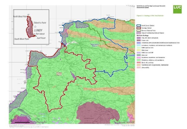
Little Dart River and Valley showing Contour Lines
   
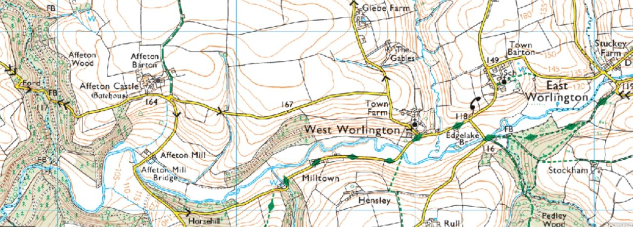
Ordnance Survey base mowing contour lines and the Tithe Apportionment field boundaries i
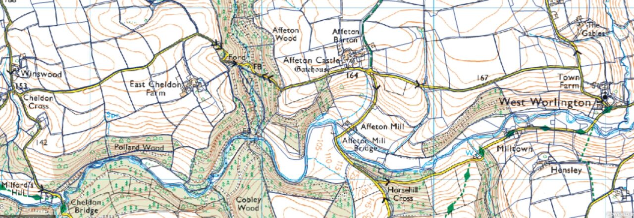


Copyright © 2026 · East Worlington Parish Hall · Registered Charity 267969 · Log in