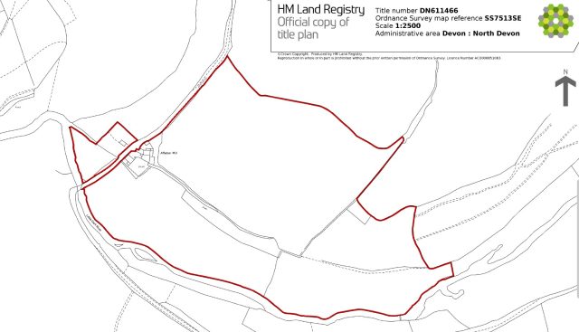
Property Description
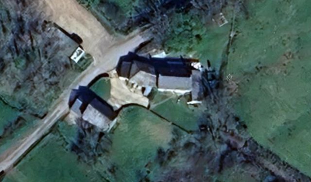
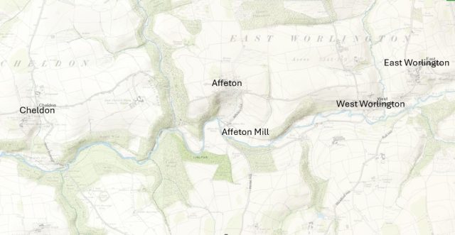
Affeton Mill is situated adjacent to the Little Dart River in the bottom of the valley immediately below Affeton Castle, at a distance of approximately 0.5 kilometers.
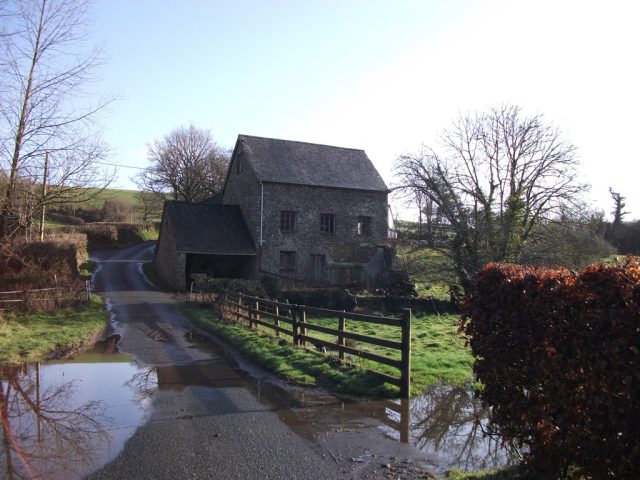
The photograph shows the south facing elevation of the Mill approaching from Affeton Mill Bridge.
The Mill is of stone construction with a slate roof.
The mill itself has a dwelling property on the same site. It i s located to the north side of the mill and therefore the mill hides it from view in the photograph
.While, in 2026, the waterwheel has gone the pit remains outside the southeast wall and the leat is evident but chocked up.
It is probable that a Mill existed from the early times of the establishment of a settlement at Affecton which is referenced in the document Affeton Castle A Lost Devon Village as second half of the C13th.
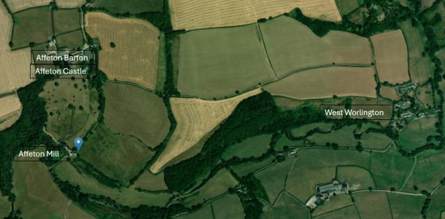
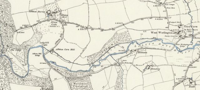
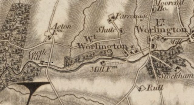
| he Leat This map of 1888 shows the location of Affeton Mill in relation to Affeton Castle and West Worlington. The map shows the position of the Mill Leat including the mere near to West Worlington, where the river water was divert to the Leat in which it flowed to the Mill to drive the water wheel. Once the water had powered the wheel it flowed back into the Little Dart River, presumably by a sluice gate (which was the most common method used for this function) but there is no empirical evidence that confirms Affeton Mill has a sluice gate mechanism) |
Timeline
410 AD to 1066
Setting the Scene – Property, People, Place – The Saxons
Evidence of early settlements is provided by their names that originate in the Anglo Saxon period.
When the suffix “ton” is part of a place name it signifies a homestead of Saxon ·settlement, as found in the place names of Affeton, and West and East Worlington,
The Anglo-Saxon suffix ‘don’ means a hill or fortified hill.
Therefore the three neighbouring Saxon settlements of Affeton, the Worlingtons and Cheldon which are located along the North slope of the valley of the Little Dart River, provide strong evidence that people were living in these locations during the Saxon period.
Research suggests that the diet of the Anglo-Saxons generally included grains, vegetables, and some meat. Bread, made from wheat, rye, barley, and oats, was a staple, along with vegetables like peas, beans, onions, leeks, turnips, and root vegetables. By applying this to the Saxons who formed settlements in the Little Dart River valley they would require a method to grind grains into flour for bread making. Historical records show that Saxons did have mills, particularly watermills, which became increasingly common by the 8th and 9th centuries. So while there is no evidence of the date of origin of Affeton Mill, the general statement in the A Lost Devon Village booklet that ‘a mill probably existed from the early days’ could have been possible.
Late C13th
The Village of Affeton
1765
Donn’s map of Devon
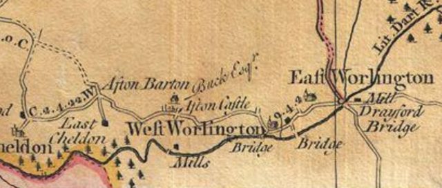 M. Bodman, in Watermills and Other Water-Powered Sites in Devon, states Affeton Mill’ in West Worlington is a stone building with a slate roof by the side of the road. The mill was shown as a grist mill on Donn’s map of 1765. The waterwheel has gone but the pit remains outside the southeast wall & the leat is choked. A grist mill is a historic building or machine that grinds cereal grains (like wheat, corn, or oats) into flour, meal, or animal feed. Powered traditionally by water wheels or windmills, they use heavy stones to crush grain, serving as vital community hubs where farmers brought crops for processing, often paying a percentage of the grain as a feKey details about grist mills: Water channels through a raceway, turning a water wheel, which powers shafts and gears that rotate large grinding stones. Grain is fed from a hopper between two stones (a stationary “bed stone” and a rotating “runner stone”) to crush it. Beyond just flour, they were used to produce cornmeal, grits, and livestock feed. Common for centuries, they acted as local economic centers in the U.S. and elsewhere, often located near dams to harness water power.
1809
Affeton Mill named Castle Mill in 1803 to 1807 OS Survey
Press Cuttings
| This Notice was posted in North Devon Journal in 1885 and identifies the property as a Water Grist Mill, a Dwelling House and Buildings and an Orchard and Pasture Land. | 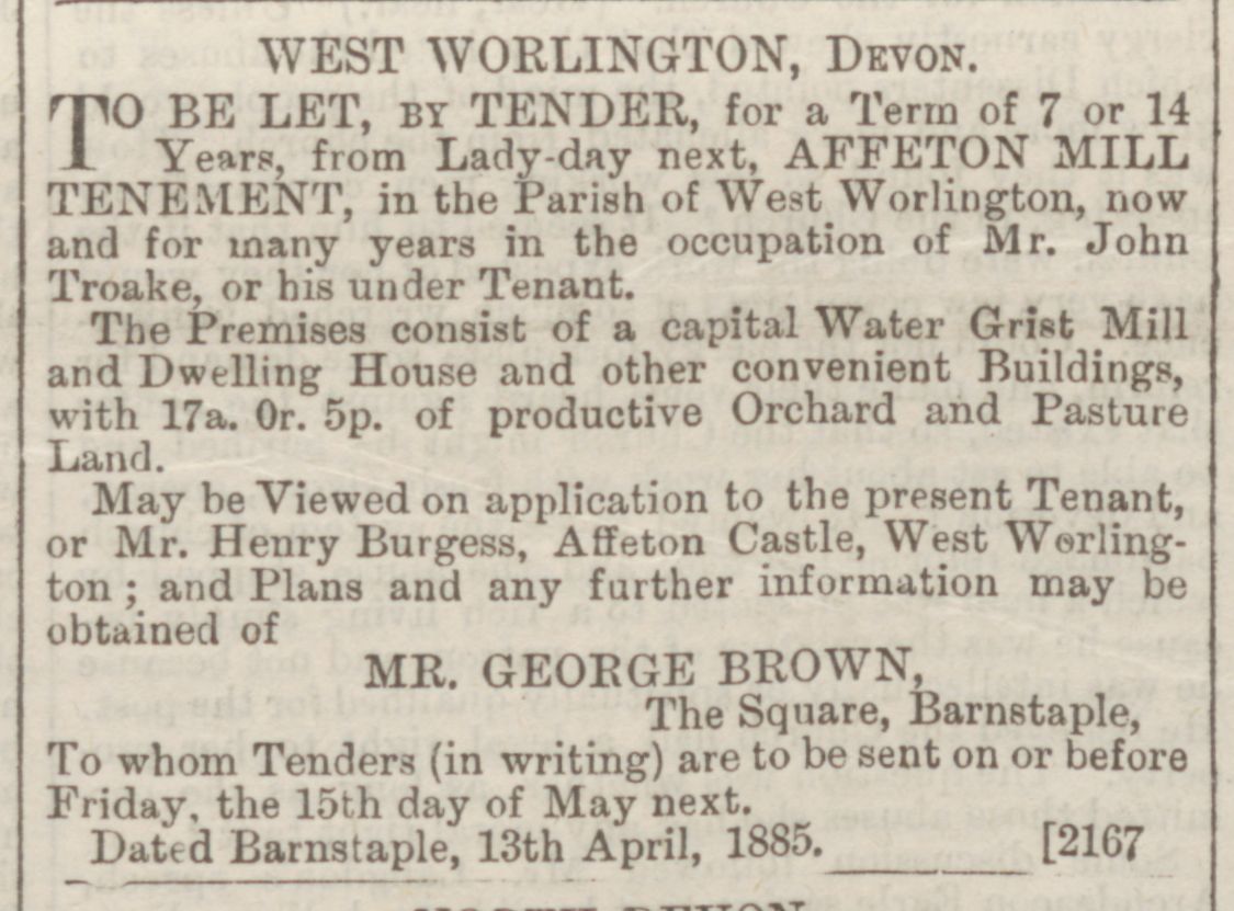 |
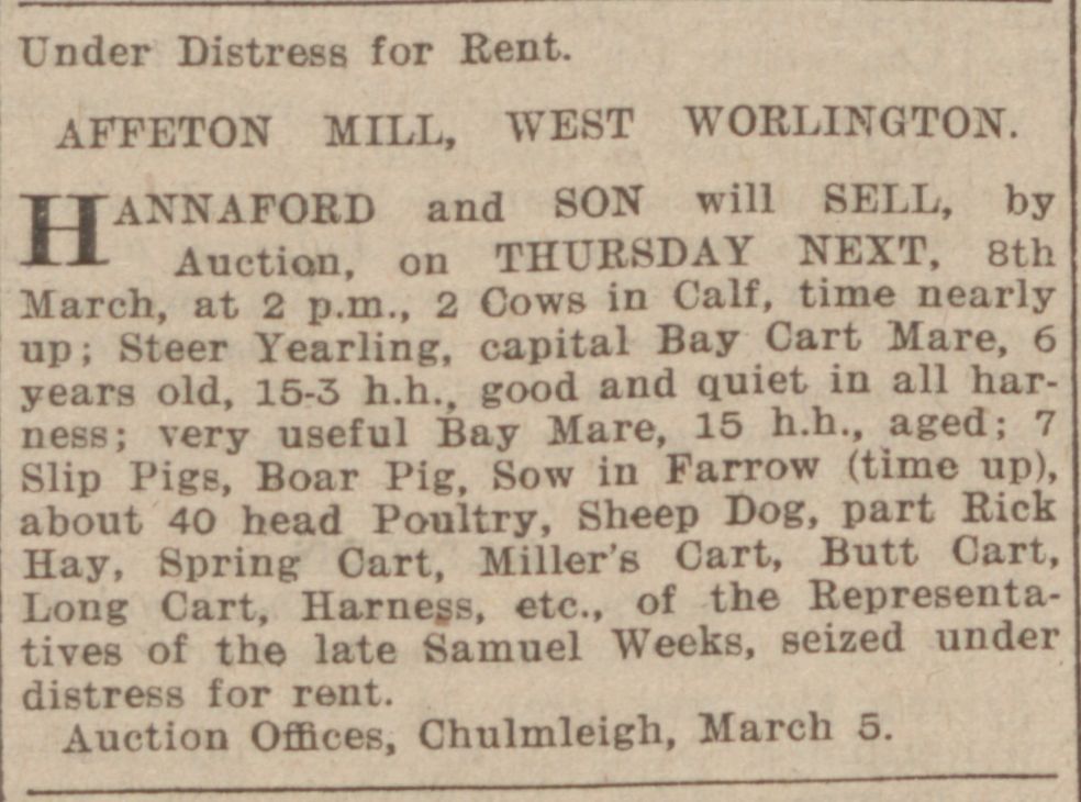 |
In 1907 the sale at Affeton Mill was conducted under the distress of rent and the article lists and illustrates the items the the last owner, the late Samuel Weeks owned and there was no reference to anything that suggested milling was still taking place. |