Archaeological Research – Skills and Techniques
There were three main approaches explained by Bryn
- Desk-based Assessments;
- Archaeological Prospection; and
- Historic Building Analysis
Through desk-based research and interviewing the archaeologist Worlington Heritage Group were able to clarify the key skills beneficial to the role of archaeologist.
This document also shows examples how the learn has been applied by Worlington Heritage Group to East Worlington Parish Hall.
Desk-Based Assessment
The Importance of maps
Maps are a vital element of desk-based research. There are number of sources of maps ranging from first hand editions, maps produced as a result of different types of surveys and website locations for interactive maps. The list below offers just some examples of maps explained as part of the talk.
- Historic Landscape Characterisation Maps (Devon County Council) (DCC)
- Tithe Maps
- First Edition OS 25 inch 1880 -1899
- Second Edition OS 25 inch 1904 – 1906
- OS Maps
- Benjamin Donn Wall Map of Devonshire and Exeter, England 1765
- Map of the County of Devon, by C. Greenwood, 1825 & 1826
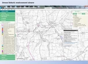
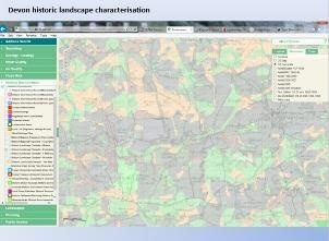
Examples of Maps Available from DCC Historic Landscape Characterisation Maps
https://new.devon.gov.uk/historicenvironment/the-devon-historic-environment-record/historic-landscape-characterisation/
Places Names
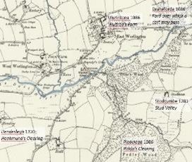
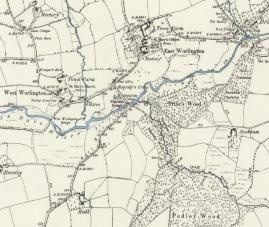
Place names provide valuable information about the evolution of the human environment. The Maps below show some historic place names for settlement and landscape feature (e.g. woods) around what is now East Worlington.
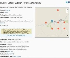
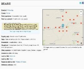
A useful interactive resource is the Doomsday Book Online which enables research of settlements and their composition and wealth at the time of the survey (1085). Examples are shown in the photographs below. https://opendomesday.org/
Field Names
Field Names can highlight areas of interest that require further exploration.
For example, this field names map of East Worlington shows traditional names associated with field locations, field uses and field ownership.
There are however two fields of particular interest Higher Ilcheston and Lower Ilcheston that may have their origins associated with Roman connections. The spelling is very similar to what is now Ilchester in Somerset.
Using Tithe Maps and Tithe Apportionments
The tithe maps and apportionments are an important source of information about the history and topography of a parish. They provide details of land ownership and occupation, and the type of cultivation of the land, and are often the earliest complete maps of parishes. They were produced in order to assess the tithe payable in cash to the parish church for the support of the church and its clergy. This tithe had been paid in kind until The Commutation Act was passed in 1836, when it was agreed that this should be converted to a monetary payment.
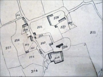
Tithe Map of 1839 showing church No. 336, East Worlington House (Rectory) No. 335 and Parish Hall (Barn) as part of curtilage of East Worlington House No 335
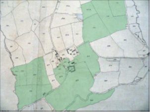
Glebe (also known as church furlong, rectory manor or parson’s close(s)) is an area of land within an ecclesiastical parish used to support a parish priest. The land may be owned by the church, or its profits may be reserved to the church.
Tithe Map of 1839 Showing Glebe Land in Green
East Worlington an extract from From White’s Devonshire Directory (1850)
The rectory, valued in K.B. at £7. 15s. 10d., and in 1831 at £238, is in the patronage of the Hon. Newton Fellowes, and incumbency of the Rev. Benj. Clay, M.A., who has a neat thatched residence, and 66½A. of glebe. . .
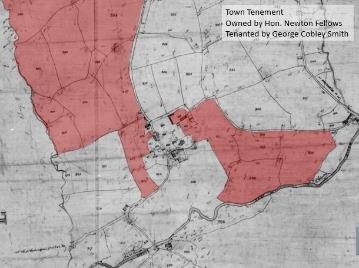
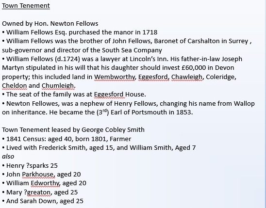
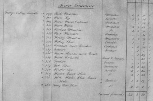
An East Worlington Example of Tithe Apportionment – Town Tenement
Map Highlighting Some of the Land Associated with Town Tenement
Information about Town Tenements
The photographs below provide an example of the Tithe Apportionment documentation showing an entry for Honourable Newton Fellows landowner and the extract from one of his tenants George Cobley Smith of Town Tenement.
