EWPH Home East Worlington Community

East Worlington Parish Hall

  • Community
  • Parish Hall
  • Heritage
  • About East and West Worlington
  • Noticeboard
  • Event Calendar
  • Guestbook
  • Contact Us

Our Location

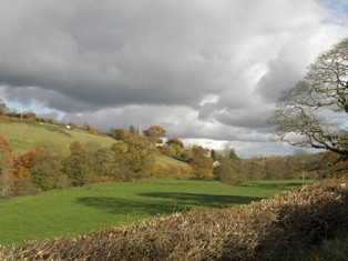
East and West Worlington are two small picturesque villages located within the Civil Parish of East Worlington and nestle within a predominantly pastoral countryside on elevated land between Exmoor and Dartmoor.

The Parish, which also includes part of the hamlet of Drayford (Drayford History), Affeton and the surrounding farms and dwellings is situated in the southern margins of North Devon District Council area, with the nearest large village being Witheridge and nearest market town being South Molton.

Get Directions

Add Waypoint
show options hide options
Print directions Reset directions
Fetching directions......
Reset directions
Print directions

River Dart Rural Scene

East Worlington Parish covers an area of approximately 28 square kilometres. The majority of the land is used for farming and there are some woodland areas. Many farms support dairy farming, with some farms keeping sheep flocks, and a small number of farms maintaining beef herds.  Much of the woodland is privately owned and managed. Footpaths, which cross the privately owned farmland and woodland, provide public rights of way and are well signed.

The population of East Worlington Parish is approximately 241 and has 89 households (2001 Census). The Parish Plan, developed in 2007 showed a high percentage of retired and self-employed residents with agriculture being the predominant employment.

River Dart

The valley, hill and moor landscape of the area was mainly created by the carboniferous rock of sandstone and shale being strongly folded during the Variscan orogeny period. This rock formation is overlaid with some loamy soil in the valley areas and clay soils in other areas. The height of land above sea level ranges from approximately 100 metres to just above 200 metres.

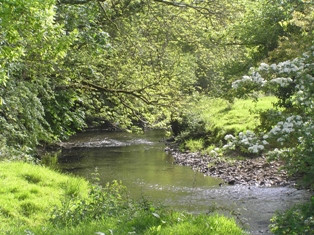
The main water course is the Little Dart River and its tributaries with the Adworthy Brook forming part of the eastern boundary to the Parish and the River Dalch a southern boundary.

The majority of roads in Worlington area are less than 4 metres wide (shown in yellow on Ordnance Survey maps). In addition the B3042, Witheridge to Chawleigh road, is routed east to west to the south of the parish and the B3137 Witheridge to South Molton road is routed across the north east part of the parish.

Copyright © 2025 · East Worlington Parish Theme on Genesis Framework · WordPress · Log in